
Accurate measurements are the backbone of successful construction, surveying, and design projects. Mistakes in measurement can lead to costly delays, structural problems, or design flaws. As technology evolves, lidar scanning has emerged as a powerful alternative to traditional measuring techniques. With its ability to capture detailed three-dimensional data, lidar is changing how professionals approach measurement tasks. Yet, traditional tools like tape measures, laser distance meters, and total stations continue to be widely used for their simplicity and reliability. Understanding how lidar scanning compares to conventional methods can help teams choose the most effective approach for their projects.
The rise of lidar scanning reflects the increasing demand for precision and efficiency. Unlike traditional measuring, which often requires manual calculations and repeated checks, lidar uses laser pulses to collect millions of data points in minutes. The resulting 3D models allow architects, engineers, and surveyors to visualize and analyze spaces in ways that were previously time-consuming or impossible. However, lidar is not a one-size-fits-all solution. For smaller projects or tasks requiring immediate on-site verification, traditional methods often remain the practical choice.
The decision between lidar scanning and traditional measuring ultimately comes down to project requirements, budget, and desired level of detail. Each approach has distinct advantages, and understanding these differences ensures that teams can optimize accuracy, efficiency, and safety. By evaluating both options carefully, professionals can avoid costly mistakes and achieve reliable results.
How traditional measuring works
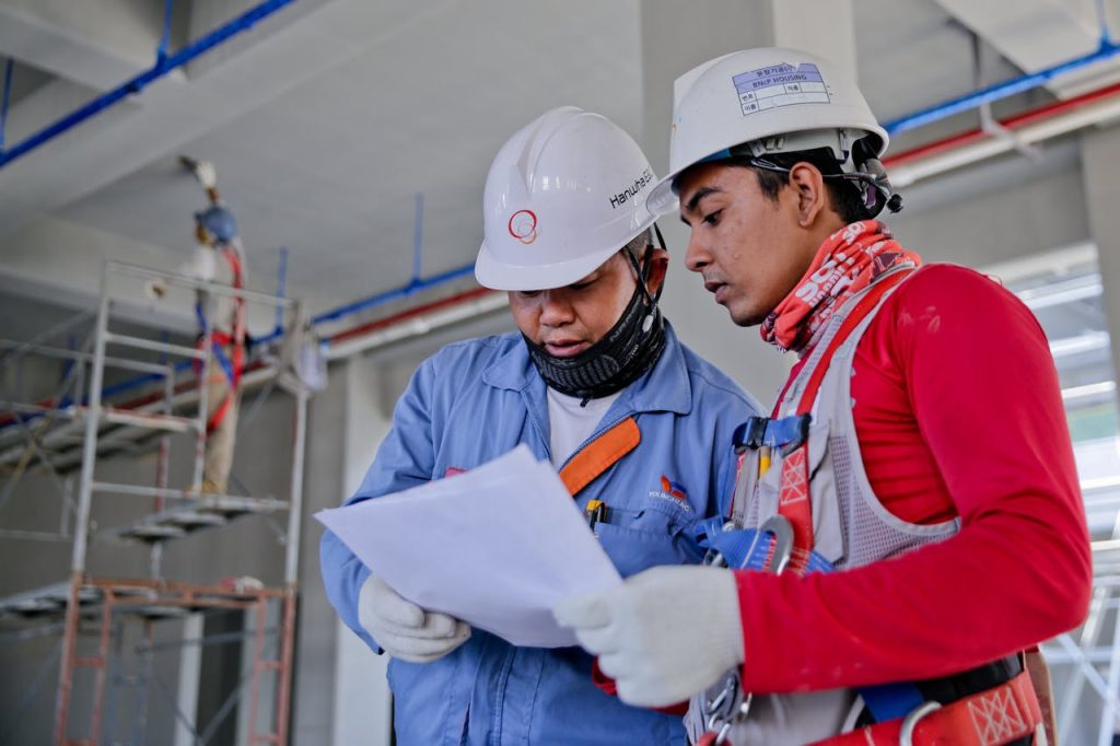
Traditional measurement techniques rely on manual tools and human oversight. Tape measures, laser distance meters, total stations, and theodolites have been used for decades in surveying and construction. These tools are effective for linear measurements and relatively small projects, requiring minimal technological training. Accuracy depends on careful execution and repeated verification to reduce human error.
Some situations where traditional measuring remains ideal include:
-
Small interior renovations or property surveys
-
Areas where lidar equipment may be impractical due to space or interference
-
Tasks needing immediate, on-site results without digital processing
-
Budgets that cannot accommodate the cost of lidar technology
These methods are portable, accessible, and allow for real-time judgment and decision-making by experienced professionals.
The lidar scanning advantage
Lidar scanning leverages laser pulses to measure distances and create highly detailed 3D representations of objects and environments. Unlike traditional methods, lidar collects vast amounts of data rapidly, generating point clouds that can be used for modeling, simulations, and design verification. Key benefits include:
-
Exceptional accuracy, often within sub-centimeter tolerances
-
Rapid data collection over large or complex areas
-
Remote scanning that improves worker safety
-
Ability to capture areas that are difficult or dangerous to access
-
Digital records that can be archived or referenced in future projects
These advantages make lidar particularly valuable for large-scale projects, intricate structures, or environments where safety is a concern.
Comparing efficiency and accuracy
While lidar scanning offers impressive speed and precision, traditional measuring has its strengths:
-
Minimal setup required for immediate measurements
-
Lower cost and accessibility for smaller teams
-
Real-time interpretation without the need for extensive data processing
-
Reliance on human judgment in ambiguous or complex situations
In many cases, the best approach is not choosing one over the other but combining them to achieve maximum reliability.
Steps for integrating lidar scanning and traditional methods
A hybrid workflow allows professionals to leverage the strengths of both methods. A practical approach could include:
-
Conduct an initial lidar scan to create a comprehensive 3D model of the site.
-
Identify key areas or critical points that require verification.
-
Use traditional tools to measure these points, ensuring accuracy and addressing any discrepancies.
-
Merge the lidar and traditional measurements into a unified dataset for planning, analysis, or design.
-
Document and archive both datasets for future reference or project modifications.
This combined method reduces errors, speeds up project timelines, and ensures a high level of confidence in measurement accuracy.
Choosing the right approach for your project
Several factors should guide the decision between lidar scanning and traditional measuring:
-
Scale of the project: Large or complex sites benefit more from lidar technology.
-
Precision requirements: Projects needing high-detail measurements justify lidar use.
-
Safety considerations: Hazardous or hard-to-reach locations favor remote scanning.
-
Budget constraints: Traditional tools are more cost-effective for smaller projects.
-
Team expertise: Skilled operators are essential for processing and interpreting lidar data.
Understanding the trade-offs between speed, cost, accuracy, and practicality ensures that teams select the measurement method that aligns with project goals and constraints.
Ultimately, lidar scanning is transforming measurement practices, providing unmatched efficiency and detailed 3D data. Traditional measuring techniques, however, remain valuable for smaller-scale projects, quick verification tasks, or situations where human oversight is critical. By evaluating project needs carefully and sometimes combining both methods, professionals can ensure reliable, precise, and efficient measurements while reducing risks and maximizing workflow effectiveness.